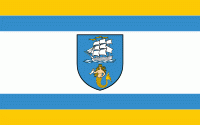
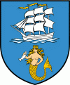
Ustka
 |
 |
The first settlers arrived at present-day Ustka as early as the 9th century, and established a fishing settlement with the original name of Ujść. In the 10th century, it became part of the emerging country of Poland under its first ruler Mieszko I. The first historic records mention the village of Ujść or Ujście in 1310.
The area at the mouth of the river Słupia was ceded to the nearby city of Słupsk in 1337 with the purpose of building a fishing harbour and a commercial port there to the Baltic Sea. According to documents in 1355 a church was built. In 1382 the city of Słupsk (Stolp) became a member of the Hanseatic League. The settlement was located in the Duchy of Słupsk, a vassal duchy of the Kingdom of Poland, and later it passed to the Duchy of Pomerania.
The town was given to Brandenburg-Prussia following the partition of the Duchy of Pomerania after the Treaty of Westphalia in 1648, and from the 18th century it formed part of the Kingdom of Prussia. On August 1, 1778, a blaze destroyed 18 houses which, however, were soon re-built. In 1871, the town became part of the German Empire. The first railway station was opened in 1878. The rails were transported by the sea and the bedding for the track was formed by sand taken from the dunes on the Western Beach. The first passenger train departed on 1 October 1878. The rail was also used as a main transport facilitating the trade from the harbour. The rail track was extended to run into the harbour, trading mostly grain and spirits. Records state that in 1887, the local harbour shipped 5 million litres of plain spirits. The Harbour lost its importance after the World War II, fishing taking priority over trade. The current shape of the harbour is a result of an investment between 1899 and 1903 creating the largest port between Stettin (Szczecin) and Danzig (Gdańsk).
The restoration of independent Poland and creation of the so-called Polish Corridor at the end of World War I separated the German exclave of East Prussia from the German Province of Pomerania. As a result, the German Ministry for Transport established a ferry connection to East Prussia ("Sea Service East Prussia" or Seedienst Ostpreußen) in 1922, independent of the transit through Poland. These ships also harboured in Stolpmünde. Because of the increasing traffic it was planned for the harbour to be enlarged and modernized. The gigantic new development kicked off at the beginning of 1938. A third pier was started as docking station for the largest vessels. The construction of the new port was halted on 23 September 1939 after the German Invasion of Poland. During World War II, the Germans operated a forced labour subcamp of the Stalag II-B prisoner-of-war camp for Allied POWs.
The old part of the town has retained its layout since the Middle Ages. The small residential buildings were modernised in the thirties of the 19th century, however the layout of the streets was not changed. Since 2005, Ustka's authorities and the European Union embarked on the Revitilisation Programme for Old Ustka. Many buildings have and are being restored.
Monuments in the town include a lighthouse from 1871 (rebuilt to include the octagonal tower in 1892), Main Post Office from 1875 and church from 1882.
After World War II, the new Polish authorities took steps to determine an official name to replace the German 'Stolpmünde'. Ujść, Uszcz, and Ustka were all posted on the main railway station in 1945; Nowy Słupsk was the name on the sign at the main Post Office; Postomino was the town's name at the town hall; and Słupioujście was posted at the Harbour Master's office. The final name, Ustka, was decided upon in the late 1940s.
From 1975 to 1998, it was administratively located in the Słupsk Voivodeship.
Map - Ustka
Map


Country - Poland
 |
 |
| Flag of Poland | |
Poland has a temperate transitional climate and its territory traverses the Central European Plain, extending from Baltic Sea in the north to Sudeten and Carpathian Mountains in the south. The longest Polish river is the Vistula, and Poland's highest point is Mount Rysy, situated in the Tatra mountain range of the Carpathians. The country is bordered by Lithuania and Russia to the northeast, Belarus and Ukraine to the east, Slovakia and the Czech Republic to the south, and Germany to the west. It also shares maritime boundaries with Denmark and Sweden.
Currency / Language
| ISO | Currency | Symbol | Significant figures |
|---|---|---|---|
| PLN | Polish złoty | zÅ‚ | 2 |
| ISO | Language |
|---|---|
| PL | Polish language |